As if dealing with a pandemic were not bad enough, residents along the Eastern Seaboard and Gulf Coast will now have to live under the specter of another menacing threat: a 2020 Atlantic hurricane season that could end as one of the busiest on record.
The National Oceanic and Atmospheric Administration (NOAA) is forecasting 13 to 19 named storms, of which six to 10 could become hurricanes, including three to six major cyclones.
Forecasters delivered the grim news nearly two weeks before the official June 1 start of the season, which, for the sixth year in a row, got off to an early start when tropical storm Arthur formed off Florida’s east coast on May 16.
That preseason storm only brushed North Carolina’s Outer Banks, dumping as much as four inches of rain in some areas. It was followed by another early arrival, tropical storm Bertha, which formed quickly off the coast of South Carolina last week and made landfall east of Charleston, bringing heavy rains. And for the first time, a third named storm may form in the Atlantic.
While the first two systems were short-lived, what hasn’t been fleeting is an ongoing temperature anomaly that continues to have a bearing on the Atlantic hurricane season. And this year, that anomaly—warmer-than-average sea-surface temperatures—is again increasing the likelihood that the season will be an active one.
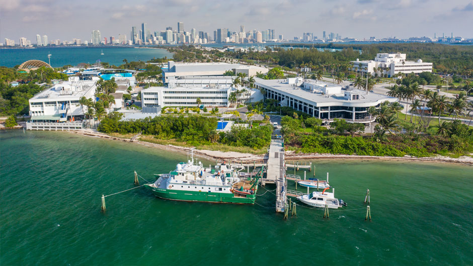
“Not only are those warmer temperatures conducive to hurricane development if they stick around, but they are also indicative of a weaker-than-normal subtropical high pressure, which weakens the trade winds, decreases vertical wind shear [vertical wind shear can tear a hurricane apart], and lowers the ambient pressure in the tropical Atlantic,” said Brian McNoldy, a senior research associate and tropical cyclone expert at the University of Miami Rosenstiel School of Marine and Atmospheric Science.
Another factor driving the strong probability of an aggressive season: the weather phenomena of El Niño and La Niña in the Pacific Ocean. Forecasters expect El Niño conditions, which tend to suppress hurricane activity, to either remain neutral or to trend toward La Niña, which stimulates storm activity in the Atlantic.
“Even though El Niño develops in the tropical Pacific, it increases shear over the tropical Atlantic by strengthening the winds in both the upper and lower atmosphere,” explained Emily Becker, an associate scientist at the Rosenstiel School who specializes in sub-seasonal and seasonal climate prediction and predictability. “These winds blow in opposite directions, creating shear and making it harder for hurricanes to develop and strengthen. Without El Niño, we don’t have shear helping to suppress hurricanes.”
The forecast for La Niña, Becker said, is borderline right now, with odds for the late summer and fall split about evenly between neutral and La Niña. “However, it’s likely that the tropical Pacific will continue to move toward cooler-than-average conditions after several months of slightly warmer-than-average temperatures,” she said. “And if La Niña does develop for the fall, it could further enhance hurricane-friendly atmospheric conditions.”
The bleak hurricane season outlook comes amid the ongoing COVID-19 pandemic, adding to the challenges communities and emergency managers will face. Concerns over the spread of the virus and the measures being taken to help prevent its transmission may have contributed to some people not spending as much time as they should preparing for the season, said Matthew Shpiner, director of emergency management at the University of Miami.
“But the good news is that there’s still time to prepare, whether it’s purchasing a hurricane preparedness kit or taking the necessary steps to ensure that you’ll be able to receive information in the midst of a storm,” he said.
But even as residents begin to prepare, it is important that they plan while keeping the virus in mind, Shpiner warned. “Our hurricane preparedness kits should be a little different this year than in previous years,” he said, noting that additional importance should be placed on making sure kits contain cleaning supplies, hand sanitizer, and personal protective equipment like masks and gloves.
“We’ve all experienced the impacts COVID-19 has had on supply chains,” Shpiner said. “So, it makes it all the more important to be working on getting these types of items now rather than waiting for a storm, when the supply chains will be impacted even more.”
The University, he said, has taken a detailed look at its hurricane preparedness plan through the perspective of how COVID-19 might impact it. “Our plans are being adapted to account for COVID-19, but it’s also important to remember the parts of the plans that have served us well and to make sure we don’t fix something that’s not broken,” Shpiner said.
Meanwhile, with the season now underway, hurricane-related research being conduct by Rosenstiel School scientists continues.
Lynn “Nick” Shay, professor of meteorology and physical oceanography, is analyzing data on Hurricane Michael, which made landfall along the Florida Panhandle on October 10, 2018, as a category 5 storm with maximum sustained winds of 161 miles per hour.
“Michael went over the Loop Current and then a cool pool, and then went over a remnant from the Loop Current and a warm eddy,” Shay said. “What was extraordinary was that the cool pool between the warm eddy and Loop Current was predicted to decrease the storm’s intensity, but it didn’t. After reviewing the data, it appears that salinity played a pretty big role in arresting a lot of the vertical mixing that occurs in many other storms.”
As part of a National Science Foundation study, Shay and his research team are preparing their hurricane-measuring instruments such as high-tech ocean buoys for deployment on NOAA and United States Air Force Hurricane Hunter aircraft. “If we get something that needs to be looked at, we’ll be ready,” he said.
And through funding from NOAA’s National Environmental Satellite, Data, and Information Service, his team is in the process of acquiring higher-resolution radar altimeter data that will help calculate measurements such ocean heat content from space more effectively.
In addition, as part of their National Science Foundation-sponsored project on hurricane winds in the urban environment, David Nolan, professor and chair of the Department of Atmospheric Sciences, McNoldy, and colleagues at the National Center for Atmospheric Research, are exploring how effective hurricane forecast models can be in predicting wind speeds over land and cities.
“Such models are currently used to predict the tracks and intensities of hurricanes, but not the impacts once they make landfall,” Nolan said. “This work aims to lead to improvements in the forecast models so they can some day also be used to predict wind speeds and gusts in towns and cities.”
Sharan Majumdar, professor of atmospheric sciences, and his research group are studying the diagnostics of processes and forecast skill related to hurricane intensification as well as the processes and predictability related to the formation of hurricanes from African easterly waves. And Brian Soden, professor of atmospheric sciences, is examining precursors to tropical cyclone rapid intensification and the role of clouds and water vapor on hurricane development.
McNoldy answered some other questions related to this year’s Atlantic hurricane season.
For the sixth year in a row, the Atlantic hurricane season has started early, with tropical storm Arthur forming more than two weeks before the official start date. In light of this, should the start date of the season be changed?
Yes, 2020 is now the sixth consecutive year with a “preseason” named storm. A preseason named storm is a tropical or subtropical storm that forms prior to the official start of the Atlantic hurricane season on June 1. While this is odd, it is part of a multi-decadal trend, but I am not so sure it warrants adjusting the bounds of hurricane season. Hurricane season is an arbitrary and artificial construct anyway and was never intended to include all activity, just most of it. Actual hurricanes almost always occur within hurricane season, so having a few outlier storms before June 1 or after Nov. 30 is fine. The last preseason hurricane was Alma in May 1970, and the last few postseason hurricanes were Alex (January 2016), Epsilon (December 2005), and Olga (December 2001). I count Alex as a postseason hurricane even though it is technically the first storm of the 2016 season. Meteorologically, its formation was a remnant of 2015 hurricane season conditions.
Just how big of a role will El Niño and La Niña play in this year’s hurricane season?
El Niño has a strong tie to Atlantic hurricane activity. During an El Niño, Atlantic hurricane activity tends to be suppressed relative to normal. On the flip side, a La Niña tends to enhance Atlantic hurricane activity relative to normal. The outlook for the peak of hurricane season is about a 50 percent chance of neutral conditions, 40 percent chance of La Niña, and 10 percent chance of El Niño. So, just a lack of an El Nino allows other conditions to play a bigger role.
Can the season outlook change later in the year because of certain changing conditions?
Absolutely, and it almost certainly will. Forecasting for very long lead times is challenging and packed full of compounded uncertainties. The closer to the timeframe of interest you get, the fewer and smaller those uncertainties become. That applies to daily weather (a five-day versus a one-day forecast) as well as seasonal hurricane activity (a four-to-six-month versus a one-to-three-month outlook). As we get closer to the heart of hurricane season—August, September, October—the large-scale environmental patterns that statistically correlate well with hurricane activity become easier to pin down. Even then, there is room for error because statistical relationships are not perfect.