After just one class at the University of Miami, seniors Erica Goldfinger and Eliza Stuart recognized the power of digital mapping tools to uncover patterns. They realized the technology could track and illuminate things like human health, climate change, and pollution—all by placing data points on a map.
It convinced both women that they needed to learn more and prompted them—independently—to take more advanced classes in geography and sustainable development, eventually leading them both to double major in the discipline.
“Maps are such a great way to visualize data effectively,” said Goldfinger, who is also majoring in ecosystem science and policy. “They are great for telling a story and making things digestible for people that don’t have a lot of expertise or background in a certain field.”
Their familiarity and interest in digital mapping also impressed geography associate professor Justin Stoler, who recruited Stuart and Goldfinger to help with research projects in his Social and Health Inequities Research and Education (SHIRE) Lab. It allowed both women to learn how to explain things geographically, like the incidence of breast cancer in South Florida, or drivers of water insecurity in rural Uganda.
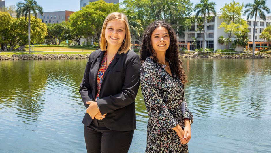
Now, both are graduating with honors from the Department of Geography and Sustainable Development in the College of Arts and Sciences as the only two students receiving the distinction this spring. Stoler hopes to find more students as enthusiastic and dedicated as these two seniors, who began working with him remotely during the start of the COVID-19 pandemic. In February, each presented her own research at the annual meeting of the American Association of Geographers and fielded questions from academics across the nation.
“They are remarkably talented,” said Stoler, a geography professor who is also affiliated with the Miller School’s Department of Public Health Sciences and the Abess Center for Ecosystem Science and Policy. “Everyone at the national conference thought they were graduate students when they presented their work. They are performing at a high bar and having a good time.”
Even during the height of COVID-19, Stoler said, he trained Stuart and Goldfinger on advanced statistical methods over Zoom and was elated that the then-juniors were eager to learn.
“Most of our collaboration has been virtual, so that’s a testament to their versatility, resilience, and motivation when there were so many distractions,” Stoler said.
As they enter the workforce, Goldfinger and Stuart both hope that their growing expertise with geographic information systems (GIS) and data analysis will help them improve the health and environment of our nation.
Interest in environment led to Miami
Goldfinger grew up in a suburb of Philadelphia and often enjoyed exploring the woods behind her home. When she was in second grade, she learned about climate change for the first time and was stunned.
“I had no idea our earth was suffering the way it was, and I thought it was crazy how people were acting like it was no big deal,” she said.
Her interest in studying the environment led her to the University, where she initially wanted to study policy.
“Miami has really good environmental programs, and it’s such an applicable city to be learning this in,” she said. “It’s a place that needs strong and effective environmental policy for survival, so I thought being in a place where these changes are imminent would be ideal.”
But once she got involved in taking ecosystems science and policy classes, like biology professor Kathleen Sealey’s “Hurricanes and Ecology,” where she visited the Everglades for the first time, Goldfinger started to realize that she was more interested in collecting and evaluating the data that supports policy. She took her first class in GIS—the software used to analyze geographic data—and was hooked.
“I would like to go into a career where I can use GIS to collect environmental data and use it as my tool to make a difference in environmental policy,” she said.
Goldfinger will do just that when she begins work this summer at the National Audubon Society as a Dangermond Fellow, a program that trains future leaders in conservation science, public policy, and digital mapping careers.
During the past four years, Goldfinger also worked as a member of the green committee for Student Government’s ECO Agency. In addition, she serves on its food sustainability committee and helps maintain the on-campus food pantry, which receives donations twice a week from the nonprofit organization Good Samaritan Meals.
In working with Stoler’s lab, Goldfinger met Stuart and the two bonded quickly on their shared interest of GIS mapping. Together, the women even helped revive Gamma Theta Upsilon, the University’s honor society in geography, and planned a week of programming to raise awareness about how geography affects everyone’s lives.
Public health focus builds at the U
Stuart, a native of Falls Church, Virginia, came to the University to study public health. Her interest in the field was ignited in high school when she read about a rare form of cancer that spread through the Puget Sound area of Washington because asbestos on pipes had leached into the drinking water.
“It was this mystery, and I realized that by tracking disease geographically, you are solving it,” she said.
At the University, her fascination with public health has only strengthened.
Stuart said that she feels fortunate that she was able to learn from some of the most seasoned global health professionals at the University, including a global health course with President Julio Frenk and Felicia Marie Knaul, professor at the School of Medicine and director of the Institute for Advanced Study of the Americas, and a health policy class with former University president, Donna Shalala.
During Shalala’s class, Stuart even got the chance to speak with guest lecturer Dr. Paul Farmer, one of the world’s great champions of public health, just weeks before he passed away. Stuart said speaking to Farmer was one of the highlights of her time at the University.
Yet, Stuart also counts Stoler’s class, “Global Water Security and Sustainability,” among her favorites because it broadened her interest in water as a worldwide public health issue. That class—and a few others—helped Stuart realize how well digital mapping and public health meld.
“So many geographic principles carry over to public health,” she said. “In nearly every class, we talk about geography because it affects every aspect of infectious diseases.”
While Stuart’s main research project focused on the spatial patterns of water insecurity in rural Uganda, she also supported research collaborations with Bascom Palmer Eye Institute. Stuart also shared her knowledge about digital mapping with other students as a teaching assistant in a “GIS for Health and Environment” course and in the Richter Library’s Digital Scholars Lab this semester.
“Learning how to encourage other people to pursue their interests and support them in conducting research is fulfilling because I love helping people, learning about new health and environmental-related issues, and applying GIS to better understand the world’s problems,” she said. “These positions have taught me a lot about research in general, which I will carry forward with me.”
After graduation, Stuart is contemplating several professional options in the health policy realm, ideally for a U.S. government agency. Specifically, she wants to improve the way scientists communicate public health research to help others understand and work to eliminate health disparities in the U.S.. Later, Stuart hopes to earn her Ph.D. in public health policy.
“Government health communications could be stronger, and their maps could be better,” she said. “If we are ever going to resolve the health disparities in this country, we need to improve our health care system, so people of all backgrounds are willing to seek and receive quality care.”