With dancing ribbons of light visible in the sky, a team of researchers flew on a series of scenic and sometimes stormy flights into the cold unknown, trying to learn more about why one of the most frigid places on Earth is warming at a feverish pace.
The researchers—a University of Miami atmospheric scientist and her two Ph.D. students—took the flights as part of a nearly two-month-long field campaign aimed at investigating to what extent clouds generated by marine cold-air outbreaks (MCAOs) reflect and potentially contribute to the rapid warming of the Arctic while also sustaining the more extreme weather events of that polar region.
The Arctic is changing rapidly, warming at a rate two to four times faster than the global average,” said Paquita Zuidema, professor and chair of atmospheric sciences at the Rosenstiel School of Marine, Atmospheric, and Earth Science and the principal investigator of CAESAR, or Cold-Air Outbreak Experiment in the Sub-Arctic Region. “A consensus on why and how this is occurring is still lacking, and questions remain on how clouds contribute or simply respond to these changes. The more we can learn about Arctic cloud behavior now, the better we can predict the Arctic of the future. Regardless, as the Arctic becomes more accessible, we will need to improve Arctic weather prediction in one of the most poorly observed regions of the planet.”
MCAOs, which can impact weather patterns around the world, occur when cold, dry air moves over warm ocean waters, with the difference in air and sea temperatures causing the ocean to release large amounts of heat and moisture into the air. As part of that extreme air-sea energy exchange, an extensive boundary layer of convective clouds forms, producing, at times, intense hurricane-like polar lows.
Those clouds are of a complex nature, consisting of both ice and liquid. But little is known about how they form and evolve. “Understanding how those clouds partition their moisture between liquid and ice is still not that well represented in models,” Zuidema said. “And that’s starting to be a big deal because liquid clouds reflect a lot of sunlight. Ice clouds tend to just snow out on the ground or ocean. So, we want to know, in very cold clouds, how much of that moisture is liquid and how much is ice, and why and how that change occurs?”
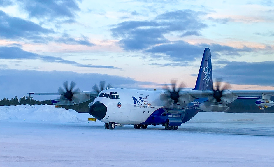
And that’s where CAESAR comes in. During the recent field camp, organized by the National Science Foundation’s National Center for Atmospheric Research, Zuidema and Rosenstiel School graduate students Sam Ephraim and Tyler Tatro flew out of Kiruna, Sweden, aboard a C-130 Hercules aircraft, traveling to the Arctic sea ice edge off Greenland and employing a suite of instruments that collected a wealth of data.
 The C-130 used in the CAESAR field Campaign warms up just before liftoff.
Dropsondes released from the C-130 recorded in-situ data on wind, temperature, and humidity as they traveled vertically through the atmosphere. Lidars, radars, and radiometers on the aircraft determined the proportion of ice and water in clouds. Instruments mounted on the aircraft’s wings sampled cloud properties, while air intakes collected aerosols for analysis.
Scientists from eight other universities in the United States as well as from Stockholm University in Sweden, the University of Oslo in Norway, and the U.S. Naval Research Laboratory also participated in the field campaign. They are examining how aerosols, air from the stratosphere, and dynamics at small scales impact cloud development. Modelers were also brought in to help facilitate a more rapid transfer of knowledge.
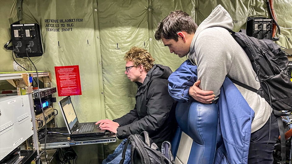
For Ephraim, who flew on four of the eight CAESAR flights, the campaign was more than an opportunity to observe senior scientists at work. He played a critical role in the mission’s success, operating the radiometer that measured the amount of radiation emitted from water vapor and liquid water in the air. In addition, he helped conduct weather forecast briefings for the team of scientists that determined whether flights on each day of the campaign would take off or be grounded.
“It’s one thing to sit in a classroom or at a computer and look at data on cold-air outbreaks that other people have collected in other field campaigns, but it’s quite another thing to actually be able to see it with your own eyes and to play an active role in the research,” said Ephraim, who as a little boy decided he wanted a career in meteorology after watching several hours of Weather Channel coverage.
“Our entire deployment was amazing,” he continued. “We saw the northern lights quite a bit. They were extremely active during the period we were there. And on the flights, seeing the transition of going from clear, sunny skies over the sea ice to stormy conditions was just remarkable.”
Tatro, who is studying biomass burning and aerosol cloud interactions over Africa, also assisted in operating the radiometer and helped plan some of the flights. For him, the campaign was “science from textbooks brought to life.”
“I got a sense of how much community there is in atmospheric science,” he said. “I’ve seen the names of well-known scientists in books and on research papers. Seeing them in action and collaborating with them gave me a sense of how passionate they are about their work.”
Preliminary analysis of the CAESAR data is now underway, with a dedicated session on the campaign proposed for an upcoming meeting of the American Meteorological Society, according to Zuidema.

