
MIAMI—A new analysis of Malaysian Airlines flight MH370 found that the most probable crash site in the Indian Ocean is near 25°S, north of area where most of the underwater search missions were performed.
The study, led by oceanographers at the University of Miami Rosenstiel School of Marine and Atmospheric Science (UM), applied probabilistic tools from nonlinear dynamics on all information that was known from the plane disappearance, including; data on the trajectories of unanchored drifting buoys from NOAA’s Global Drifter Database, known oceanographic conditions during the time and the date and location of plane debris found along the coast of Reunion Island, Madagascar, Mauritius and coastal East African countries, to reverse model the most likely crash site in the southern Indian Ocean.
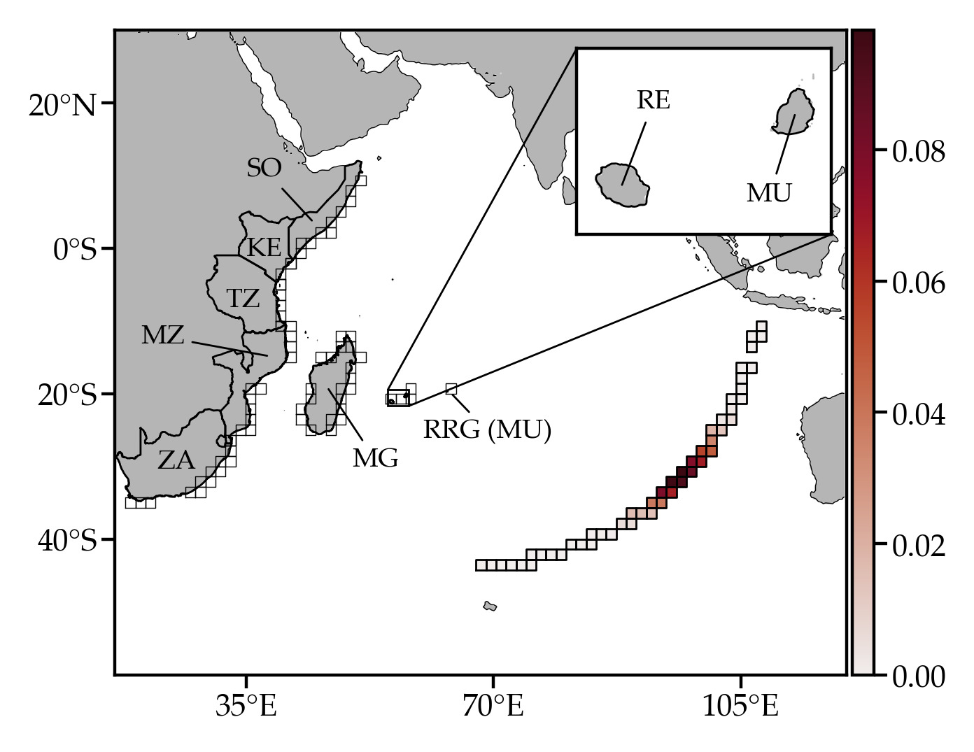
Figure 3 from the study indicates the most probable crash site location along the Inmarsat satellite arc obtained from the Bayesian inversion
“Monsoons play an important role in the dynamics of the Indian Ocean,” said the study’s lead author Philippe Miron, a postdoctoral associate at the UM Rosenstiel School. “It’s a crucial piece of the puzzle to locate the most probable crash site since its influence on the dispersion of floating debris is quite significant.”
The disappearance of Malaysian Airlines flight MH370 in the southeastern Indian Ocean on March 8, 2014 in route from Kuala Lumpur to Beijing remains one of the biggest aviation mysteries. With the loss of all 227 passengers and 12 crew members on board, flight MH370 is the second-deadliest incident involving a Boeing 777 aircraft. At a cost nearing $155 million, its search is the most expensive in aviation history. In January 2017, almost three years after the airplane disappearance, the Australian Government’s Joint Agency Coordination Centre halted the search after failing to locate the airplane across more than 120,000 square kilometers in the eastern Indian Ocean. In 2018, Ocean Infinity, an ocean exploration company was unsuccessful in locating the aircraft during a several-month cruise.
The data-based Markov-chain model developed by the researchers in this new study could also help scientists track oil spills, and other types of marine debris and pollutants in the ocean.
The study, titled “Markov-chain-inspired search for MH370,” was published April 30 in the journal Chaos: An Interdisciplinary Journal of Nonlinear Science. The study’s authors include: Philippe Miron, Francisco J. Beron-Vera and Maria J. Olascoaga of the UM Rosenstiel School of Marine and Atmospheric Science and Péter Koltai from Freie Universität Berlin.