The color of the ocean can tell scientists a lot about what’s going on beneath the surface.
How green the water appears in a particular spot, for example, can provide insight into how much phytoplankton is present, a key indicator of the ocean ecosystem’s health and the health of our planet. Phytoplankton, a type of marine algae, provide food for many sea creatures and play an important role in climate regulation by producing oxygen and absorbing carbon dioxide. On the other hand, brownish colors in ocean water can indicate the presence of dissolved organic materials from land or sediment discharged from rivers.
“All of these colors are directly related to what’s in the water and, of course, what’s in the water is what we want to know if we want to monitor ocean health or productivity or changes to circulation,” explained Art Gleason, a research associate professor in the Department of Physics at the University of Miami College of Arts and Sciences.
Due to the vastness of the world’s oceans, scientific agencies like the National Oceanic and Atmospheric Administration (NOAA) and the National Aeronautics and Space Administration (NASA) use satellites to monitor ocean color from space. The satellites alone aren’t enough, though. The agencies need sensors on the surface of the ocean that can confirm what the satellites are observing. That way, they can correct calibration errors and ensure accurate measurements.

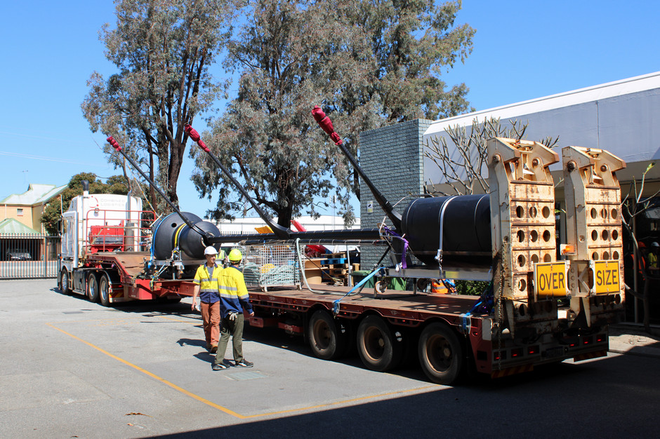
The MarONet buoy loaded on a truck for transport between Curtin University and Fremantle Harbor in Australia in preparation for deployment on Sept. 17, 2024. Photo: Mike Feinholz
“Satellite remote sensing is a fantastic tool, but by itself it’s insufficient,” Gleason said. “You need to always tie those satellite measurements to ground-based, or in this case ocean surface-based, in situ measurements to make sure that what you’re measuring from the satellite is actually grounded in reality.”
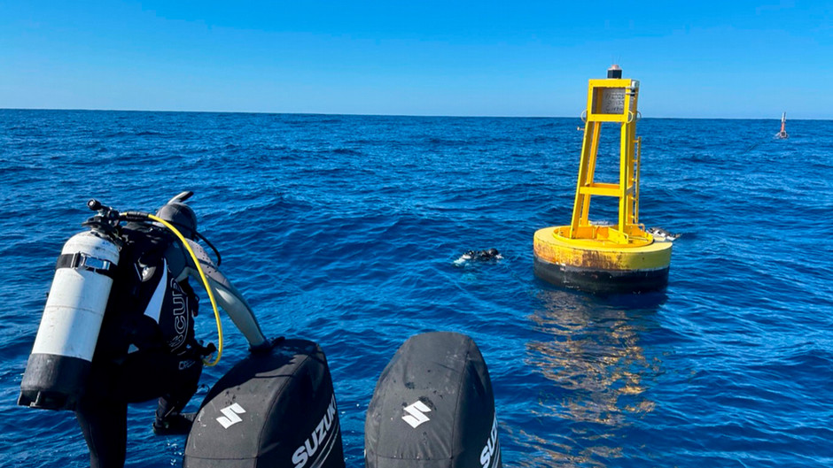
That’s where Gleason and his team come in. They recently deployed an ocean color sensor buoy off the coast of western Australia to help NASA calibrate the sensors on its PACE (Plankton, Aerosol, Cloud, Ocean Ecosystem) satellite, which the agency launched earlier this year.
The 15-meter-tall (50-foot) buoy is part of the MarONet project, which stands for Marine Optical Network. Sponsored by NASA, the project is a partnership between the University of Miami, Curtin University in Australia, San José State University, and the National Institute of Standards and Technology. The researchers plan to operate the buoy for at least the duration of NASA’s three-year PACE mission, although they hope to keep it running for much longer.

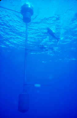
Gleason and his team know from experience that buoys like this one can operate for decades. A related project called MOBY has been deployed off the coast of Lanai, Hawaii for over 25 years. Ken Voss, now a professor emeritus in the Department of Physics, served as the principal investigator on MOBY from 2010 until his retirement last year. Gleason has since become the principal investigator on both MOBY and the newer MarONet project, with Voss serving in an advisory role.
From their posts in different parts of the world, both buoys will now help to calibrate the PACE satellite, as well as other ocean color satellites. With precise sensors, the buoys measure ocean color, producing data that can be compared with the satellite data for that location.
“By measuring the color of the ocean with both satellites and sea-based sensors, we can study the enormous impact phytoplankton have on our climate and the potential of this tiny plant to help combat climate change,” said David Antoine, a professor at Curtin University and the head of its Remote Sensing and Satellite Research Group.
This type of research has an extensive track record at the University of Miami.
“The University of Miami has a very long, rich history of ocean remote sensing science, so that’s really what drew me here in the first place,” Gleason said. “It’s been a fantastic experience being here and working on these ocean remote sensing problems.”
Gleason, an oceanographer by training, began working with Voss in the Department of Physics in 2009 after completing his Ph.D. at Rosenstiel School of Marine, Atmospheric, and Earth Science.
In addition to his work on ocean color, Gleason also helps develop other remote sensing tools with environmental and conservation applications.

