Newcomers navigating an unknown location today are likely to swipe open their cell phone to find the nearest Starbucks, or Thai restaurant for lunch, or to avoid a traffic jam.
Hundreds of years ago, however, New World navigators might well have depended on the handiwork of William Hack, a virtually unknown—yet highly innovative—17th-century historian and cartographer.
Hack’s maps detailed coastlines of the Americas, especially those of South America’s western coast; charted safe spots to anchor; and highlighted where to find food, wood, water, and other resources—even where treasure-laden shipwrecks had settled on the ocean floor.
Historian Chet Van Duzer’s webinar, “Shipwrecks, Treasures, and Maps at the End of the 17th Century: The Manuscript Atlases of William Hack,” highlighted the importance and evolution of the English cartographer. The webinar was facilitated by Arthur Dunkelman, curator of the Jay I. Kislak Collection of the Early Americas, Exploration, and Navigation in the University of Miami Otto G. Richter Library on the Coral Gables Campus.
Little is known about Hack—there are no existing portraits—yet his innovative mapmaking profoundly influenced the cartography field and very probably the course of history, according to Van Duzer, a member of the University of Rochester’s Lazarus Project.
Hack was in some degree a precursor to both Expedia and Wikipedia, because his maps included tips of where adventurers should anchor for the night and locate critical resources. And he annotated and updated his atlases with new information, such as amounts of gold, silver, and gems—exploited treasures of the Spanish colonization—that were lost when ships sunk.
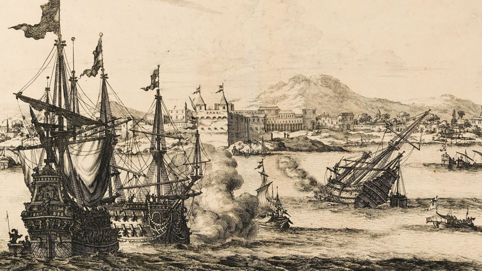
To improve their chances of safe passage from and to the Americas, Spanish sea captains maintained “derroteros,” secret ship logs that contained critical navigational aids and details of where shipwrecks had occurred—essentially as a warning to other captains to avoid a similar fate.
Van Duzer shared the famous anecdote of the Spanish captain whose galleon, about to be boarded in 1681 by an English privateer, tried to throw the derroteros overboard—but the attempt was thwarted. “Fare well south seas,” the captain allegedly lamented, recognizing that with the sailing secrets now in foreign hands, Spain’s power in the South Pacific would be forever compromised—which indeed proved true.
Hack copied the derrotero model, but, especially with his later maps, added details about the amount of shipwrecked treasure that had been lost, not as a warning of shoals to avoid but as an enticement to recovery. This information became highly prized in elite circles, such as that of Christopher Monck, the second Duke of Albemarle—the most successful treasure seeker in history.
The duke was one of Hack’s early patrons, Van Duzer noted, and the cartographer dedicated maps to him. Van Duzer suggested that this relationship was a major motivator for Hack’s annotative techniques.
“Hack was abundantly aware of Phips’ (William Phips, ship’s captain and treasure hunter) successful recovery of treasure on the West Coast of the New World,” noted Van Duzer.
Despite the fascination with Hack’s so-called treasure maps, Van Duzer recognized that his notations of shipwreck sites never led to the actual recovery of treasure.
“The prospect of sending English ships to the Pacific coast of the New World to try to recover these treasures didn’t find much favor in England, yet others understood this value in market forecast and revised work much better than himself,” said Van Duzer.
With the added value of treasure information, Hack’s maps—elaborate hand-painted manuscripts—fetched a much greater price than other maps of the time. Others, though, appreciated this value-added information far more than Hack himself. One of his atlases was resold for 25 times its original purchase price to a buyer who was highly motivated to glean accurate information of shipwreck locations—the king of Spain himself.
Of Hack’s 12 atlases reviewed by Van Duzer, the half dozen produced later in his career—those with information about the shipwreck locations—are housed in museum collections in the Americas.
The Kislak Collection does not possess any of Hack’s manuscripts but does house one of the most extraordinary collections of artifacts from the Americas in the world.