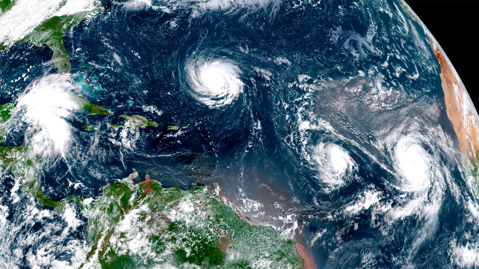
From the day it emerged as a tropical wave off Africa, University of Miami hurricane and climate researchers have been informing the public about how the sixth named storm of the 2018 Atlantic hurricane season would navigate across the Atlantic, its potential impact on landfall and the science behind how Hurricane Florence earned her bad girl image. Here is just a sample of the media mentions of UM faculty:
Hurricane Florence raises questions about link between climate change and severe storms
NBC News (Monday, Sept. 10): For answers to these and other questions, NBC News MACH spoke via an online chat with David S. Nolan, professor and chair of the department of atmospheric sciences at the University of Miami's Rosenstiel School of Marine and Atmospheric Sciences and a noted expert on hurricanes and tropical weather.
Latest forecast for Hurricane Florence
CNN (Monday, Sept. 10): David Nolan, professor in the Department of Atmospheric Sciences at the
Rosenstiel School of Marine and Atmospheric Science, speaks with CNN about the impending approach of Hurricane Florence.
How Hurricane Florence became a scary super storm
Daily Beast (Thursday, Sept. 13): “The hurricane derives much of its energy from the ocean,” Sharanya Majumdar, a professor of atmospheric sciences at the University of Miami, told The Daily Beast. “When we have a relatively warm ocean, that promotes the transfer of energy through the water vapor, from the ocean to the atmosphere. That water vapor then condenses to water, that then releases latent heat, [which] provides a source for the hurricane to organize and intensify around.”
Florence's dangerous storm surge
NBC Nightly News (Friday, Sept. 14): The SUSTAIN laboratory at the University of Miami Rosenstiel School of Marine and Atmospheric Science illustrates impacts of storm surge as explained by Brian Haus, professor and chair, Department of Ocean Sciences.
Hurricane Florence has ingredients that make experts worry
ABC News (Tuesday, Sept. 11): But a weather formation known as a high-pressure ridge is parked over the U.S. East coast, preventing Florence from doing the normal turn, said University of Miami hurricane expert Brian McNoldy.
After Florence makes landfall, that ridge, now over Washington and New York, will move east — but be replaced by another one forming over the Great Lakes that will likely keep the storm stuck, McNoldy said.
Big and Viscious: Hurricane Florence closes in on the Carolinas
The News Tribune (Tacoma, Washington, Tuesday, Sept. 11): A year ago, people would have laughed off such a forecast, but the European model was accurate in predicting 60 inches (150 centimeters) for Hurricane Harvey in the Houston area, so "you start to wonder what these models know that we don't," University of Miami hurricane expert Brian McNoldy said. Rain measured in feet is "looking likely," he said.
Catastrophic rain predicted with Hurricane Florence
The New York Times (Wednesday, Sept. 12): “This could be an unprecedented disaster for North Carolina,” said Brian McNoldy, a senior research associate at the University of Miami, in a post Tuesday on his popular hurricane blog.
Hurricane Florence could linger along coast
The Washington Post (Thursday, Sept. 13): “It could sit there as a Category 3 or 4 hurricane right offshore for a day,” said Brian McNoldy, a senior research associate at the University of Miami Rosenstiel School of Marine and Atmospheric Science and a contributor to The Washington Post’s Capital Weather Gang. “That would not be good. If it gets close to the coast and just hits the coast or is just slightly inland, but then just sits there, it’s like pressing pause at the most violent part of the landfall.”
Warmer world worsens hurricanes, but what about Florence
Fox News (Friday, Sept. 14): University of Miami hurricane expert Brian McNoldy said there are too many ever-changing factors that make it hard to blame climate change specifically.

