During a hurricane season like no other, 24 Category 3 tropical cyclones slammed into Miami-Dade County in the span of just a few weeks. But remarkably, not a single home was destroyed. Not an inch of flooding occurred. No power outages were ever reported. And no lives were lost.
The two dozen cyclones were actually simulations conducted on a University of Miami supercomputer as part of a federally funded study aimed at figuring out why wind speeds and gusts generated by hurricanes vary across different landscapes—from residential communities to dense city centers.
“Trees, houses, a densely packed cluster of skyscrapers—they all have an impact on wind speed and direction,” said David Nolan, professor and chair of atmospheric sciences at the University of Miami Rosenstiel School of Marine and Atmospheric Science, who is the co-principal investigator of the study. “And wind velocity can differ from one area of a city to another, even from one side of a building to another. We’re trying to better understand such variations.”
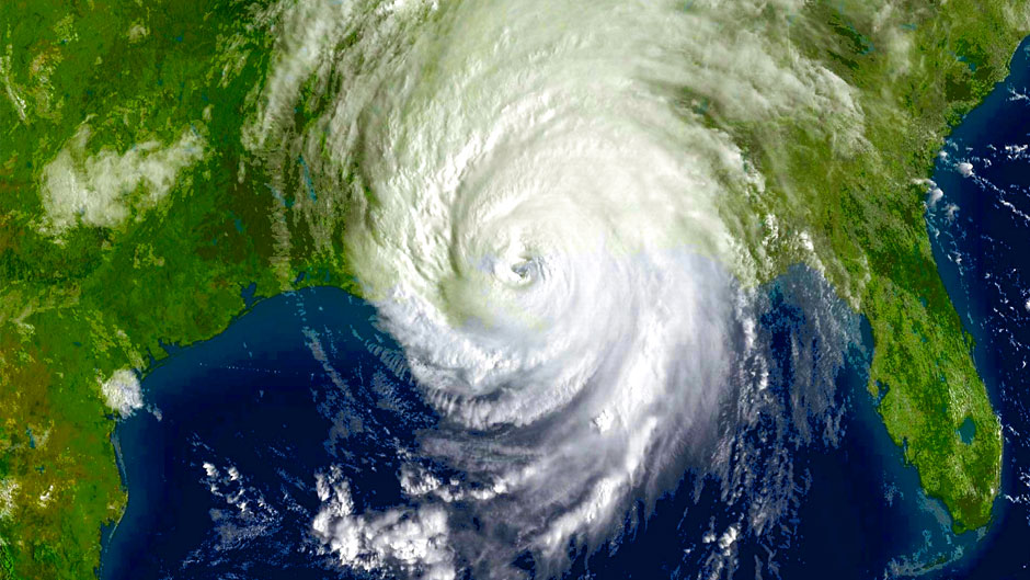
To do so, Nolan and others turned to the Institute for Data Science and Computing and its powerful Pegasus supercomputer, analyzing data gleaned from 24 simulations of Hurricane Wilma making landfall over South Florida.
Part of the record-breaking 2005 Atlantic hurricane season—during which 15 storms reached hurricane status, with seven of those becoming major cyclones—Wilma battered Florida, Cuba, southern Mexico, and parts of the Caribbean.
Simulating the historic storm proved a challenge. Brian McNoldy, senior research associate and tropical cyclone expert at the Rosenstiel School, had to “adjust the tunable parameters until the simulated Wilma resembled the actual Wilma as closely as possible in terms of track, intensity, central pressure, and the size and structure of the wind field when it passed over south Florida,” he explained.
Ultimately, McNoldy got it right, configuring and running accurate simulations of Wilma over land that could one day improve the real-time operational hurricane models forecasters rely on. “It’s one thing to get the track and intensity right, but neither of those tells you what wind impacts that specific locations on the ground will experience,” he said.
The researchers also compared data from their Wilma computer simulations with results from wind tunnel experiments conducted at the University of Florida, finding that the simulations were effective in predicting wind speeds over normal landscapes. “But in truly urban settings like downtown centers, our models have to be enhanced with additional features that have never been tested in hurricane conditions,” Nolan said.
Jimmy Ge, a first-year graduate student in Nolan’s atmospheric sciences research group, also compared the simulated winds to surface observations during Wilma and found that at most locations, the simulations could accurately reproduce how the winds changed over time during the storm.
Computer simulations of Hurricane Irma and a recent typhoon that hit China have also been conducted as part of the study, and that data is currently being analyzed by collaborators at the National Center for Atmospheric Research (NCAR).
The federally funded study, More Resilient Coastal Cities and Better Hurricane Forecasts through Multi-Scale Modeling of Extreme Winds in the Urban Canopy, has far-reaching impacts, promising not only to upgrade forecast models to account for wind speeds over land but also to predict how buildings disrupt and modify winds.
“What we don’t really know is whether buildings in urban environments help or hurt,” Nolan said. “Do they block the wind, which is good, or do they channel the wind into gusts, which is bad? We’re trying to figure that out.”
The study, Nolan said, could lead to the creation of extreme-weather apps that yield detailed data on what wind conditions will be like in specific urban locations as a hurricane passes over land. “You’d simply punch in your address and get information on what the wind speeds will be in a given area throughout the course of a storm, whether it be a suburban neighborhood or a section of a dense city center,” Nolan said.
“Sites like Weather Underground tell us what the wind will be over the course of a day, just like it does for temperature,” he said. “We don’t have something like that for hurricane conditions. We get hurricane warnings. But there’s nothing to tell us, for example, that the winds will be 50 miles per hour at 6 o’clock, 70 miles per hour at 8 o’clock, and then go back down to 50 miles per hour at 10 o’clock.”
The National Weather Service’s Point Forecast and forecasts produced by some private companies provide hourly wind estimates at a location. “But I don’t think they are accurate during hurricanes,” Nolan said.
The study is part of the National Science Foundation’s Prediction of and Resilience Against Extreme Events (PREEVENTS) program, an initiative that funds researchers to find ways to minimize the impact of natural disasters. Jason Knievel, deputy director for science in the National Security Applications Program at NCAR, is co-PI on the project.
James Hlywiak, a Ph.D. candidate in meteorology and physical oceanography at the Rosenstiel School who is advised by Nolan, is conducting a parallel study on how hurricanes weaken after making landfall and losing their primary source of energy—warm ocean waters. He will soon submit to a peer-reviewed journal the paper on the topic that he co-authored with Nolan.
“One main finding from our paper is how important the ‘roughness’ of an inland surface is on the most intense winds in a hurricane,” Hlywiak said. “Very rough coastlines—such as large urban and suburban areas, like along the east coast of South Florida, or heavily forested regions farther north—significantly weaken the most intense winds of a hurricane shortly after landfall. But smoother and more saturated land types can allow weaker yet still-hazardous winds to persist much longer and farther inland.”
Like the federally funded study, Hlywiak uses high-resolution computer simulations. But his are “idealized in that I don’t initialize my simulations using observations collected from a single hurricane but rather atmospheric and oceanic conditions typical of the tropics,” he explained. “This gives me a little more control over how my simulated hurricanes interact with the environment.”
Both studies complement each other. In his soon-to-be-published research, Hlywiak examines how near-surface winds within his “idealized” hurricanes change and are influenced by different land types. “So, we can compare the results from his simulations of Wilma to my idealized hurricanes to identify what characteristics of the near-surface winds over land are unique to Wilma and what is true for most land-falling storms,” he said.
Nolan’s research group recently submitted two papers for publication on the Wilma computer simulations. Their study will continue through August 2021.