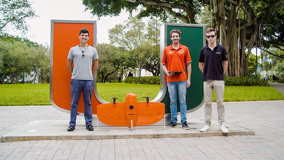
When Alexander Leiva, Whitaker Redgate, and Benjamin Kling met as first-year students on the third floor of Eaton Residential College at the University of Miami, the three could have never imagined what lay ahead in their college careers.
Certainly, they planned to obtain their college degrees, meet new people, and explore the city of Miami. But the perfect mix of friendship, academic support, and varying interests among the young men led to an innovative business venture.
The idea started when Kling, who graduated in 2020 with a bachelor's degree in international studies and a Master of Arts in International Administration in 2021, proposed a business venture to benefit Haiti during a social entrepreneurship course. While the project never came to fruition, Kling wanted to create change.
“I just remember my professors telling me that if my focus was helping the earth and helping people, they were going to empower me to do that,” Kling recalled. “And, that there would always be another way to make a change in these complex communities.”
Using his class project, Kling connected with Redgate, looking to find a way to merge his idea to fit Redgate’s personal research and model for aerial applications for ecological and land management. They then connected with Leiva, and the three students evaluated how they could use drone technologies with a particular focus on social change and impact.
And so, the trio co-founded Precision Ecology. The startup uses drone technology with state-of-the-art sensors to collect survey-grade aerial data and create digital surface and terrain maps.
“We put together all of our experiences and understandings of where there are gaps in the system to find where technology can improve something to create this,” said Redgate, a senior studying business administration with a focus on XR design and the systems developer for Precision Ecology.
In collaboration with Wingtra, a mapping drone for large-scale surveys and aerial mapping, Precision Ecology’s team can map any location using a concept called photogrammetry.
The process involves extensive drone flights in which the Wingtra captures several hundred, or thousands, of photos that can later be digitally stitched together into a photorealistic representation of an area known as an orthomosaic, digital surface map (DSM) or a digital terrain map (DTM). Wingtra can even show land contour lines—all scalable down to the size of a table, Redgate explained.
Leiva, who graduated in 2021 with a degree in sports administration, works as Precision Ecology's FAA licensed drone pilot. He noted that Precision Ecology's ability to map large areas of land digitally provides an efficient and accurate product for landowners and surveyors to analyze. He added that being able to map mass land areas via drone mitigates the danger of sending people into treacherous land conditions exacerbated by climate change.
“In one of our first flights over Puerto Rico, we were out there following tiny nails in the ground previously put down by surveyors to map the roads through the rainforest,” Leiva recalled. The maps produced by Precision Ecology, he said, were utilized to identify road areas that were more susceptible to landslides. This allowed construction crews to enter and reinforce the road areas needing support safely,” he added.
“It is no secret that these days, lots of startups are emerging from interdisciplinary applications of technology like the ones used by Precision Ecology,” said Kim Grinfeder, director of the XR Initiative and chair of the Department of Interactive Media. “For a university, it shows that there is a need and opportunity for us to develop new programs that allow for these cross-disciplinary collisions to happen more organically,” he continued. “Students get it.”
The group now has completed drone flights for clients in Florida, Puerto Rico, the U.S. Virgin Islands, and even right here at the University of Miami Coral Gables Campus.
Grinfeder and Alexander Humphreys, a lecturer in the geology department, worked with the Precision Ecology team to approve and complete their test flight over the Coral Gables Campus in October.
Leiva, Redgate, and Kling are grateful for the opportunities they received at the University to develop what was once an idea into a reality.
“I remember at orientation, President (Julio) Frenk telling us during his opening speech that we weren’t just here just to get a degree; we were here to get an education in life,” Redgate cited. “I think that’s still true. We got an experience of a lifetime as students,” he said. “All of those experiences molded us into who we are. At the end of the day, we’re just a group of friends trying to change the world in our own way.”

