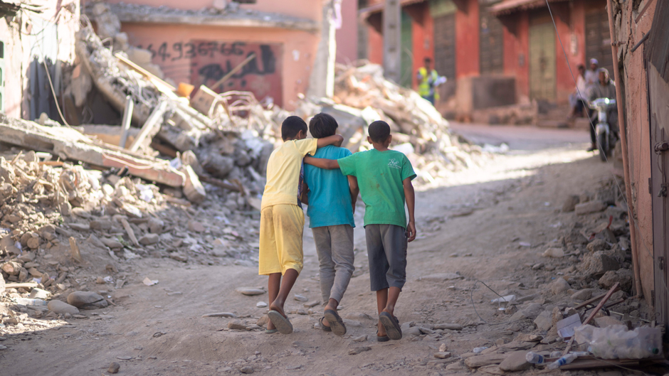
People who live in the towns and villages of Morocco’s Atlas Mountains continue to take stock of everything they have lost two weeks after a magnitude 6.8 earthquake rocked the region, killing and injuring thousands and leveling buildings.
The powerful temblor, the deadliest to hit the North African nation since 1960, is a harsh reminder that Earth’s tectonic plates are in constant motion.
But can climate change—specifically, rising rainfall rates and glacial melting—affect earthquakes, which can be triggered by changes in the amount of stress on a fault?
The connection is not as farfetched as one might think, according to Falk Amelung, a professor of marine geosciences and an expert on volcanism and tectonics at the University of Miami Rosenstiel School of Marine, Atmospheric, and Earth Science.
“There are two possible mechanisms,” he said in addressing climate’s potential impact on earthquakes in general. “One is a change in surface loads caused by the melting of an ice cap or the filling of a reservoir or even change in air pressure by an extreme weather system. The other is the infiltration of surface water if the rocks are permeable.”
The 1979 St. Elias earthquake in southern Alaska, scientists believe, was promoted by rapidly melting glaciers in the area. To investigate the link between glacial melt and the 7.7-magnitude quake, in which no one perished because of the remoteness of the faulting, scientists used aerial and ground photography along with satellite and ground measurements to estimate how much ice had been lost. The researchers then calculated how much instability the loss of ice may have caused in the Earth’s crust, finding that the loss would have been enough to spur the temblor.
Torrential rain and intense heat also could factor into the occurrence of earthquakes, according to Guoqing Lin, professor or marine geosciences. “Heavy rains and summer heat could alter near-surface stress fields by pore fluid or thermal pressurization, which could ultimately influence the occurrences and distributions of earthquakes,” she said. “However, these effects tend to be restricted to very shallow depths.”
Lin also pointed out that studies have shown precipitation might have played important roles in some volcanic eruptions, which could potentially trigger earthquakes. “In addition,” she said, “large storms like hurricanes can generate strong ocean waves, which can interact with bathymetric features on the continental shelf and trigger something called ‘stormquakes,’ equivalent to earthquakes greater than magnitude 3.5.”
Drought also can be a factor in changes in stress loads on Earth’s crust, Amelung noted. “A drought is associated with the removal of a surface load as the soils dry out,” he explained. “In California, it has been observed that a portion of the seismicity correlates with changes in surface loads from snow, snow melt, and changes in the water content in soil and shallow rocks.”
While studying potential links between climate and earthquakes is intriguing, it would do little to help predict when a quake will occur. “Earthquakes occur all the time, but they can’t be predicted,” Amelung said. “The question is not why an earthquake occurs but rather why it grows large.”
New ground-mapping technology will aid in post-earthquake rescue efforts, he noted. In the immediate aftermath of the Sept. 8 Morocco earthquake, Amelung attended a conference in the UK that examined applications of Interferometric Synthetic Aperture Radar, or InSAR, a technique for mapping ground deformation using radar images of the Earth’s surface collected from orbiting satellites.
“For the Morocco earthquake, the first InSAR image was acquired 56 hours after the event, and automatically generated damage proxy maps and earthquake source models were presented at the conference,” he said. “The damage proxy maps help inform rescue efforts. With new InSAR sensors going online, this information soon will be available the day after a quake, when it is most useful.”
Amelung answered questions related to the Mediterranean region where the devastating Morocco earthquake hit on Sept. 8.
Why is the Mediterranean “a zone of extreme but underestimated geohazards,” as you once described?
In the Mediterranean region, the African and Eurasian tectonic plates are converging at a rate of 4 to 5 millimeters per year. This is very slow but enough to create a magnitude 8.5 earthquake every 1,000 years and a magnitude 9 to 9.5 earthquake every 2,000 to 4,000 years. These earthquakes can create catastrophic tsunamis.
Why are other earthquakes expected for the region?
This is because of the steady plate convergence. There is evidence that a magnitude 9 to 9.5 subduction zone earthquake occurred near the island of Crete in 365 CE. The coastal area of the Eastern Mediterranean was completely devastated by a tsunami. In the western Mediterranean, the situation is less clear. There is no evidence for very large historic earthquakes, but this does not mean they don’t occur. And the old coastal cities are not prepared.
What is special about the plate tectonics where the Morocco earthquake occurred?
This earthquake occurred in the High Atlas Mountains about 500 kilometers south of the plate boundary. Most people consider it an intraplate earthquake in contrast to earthquakes occurring along a plate boundary fault. However, there is no fault that clearly defines the plate boundary. As there was a similar sized earthquake 100 kilometers to the west in Agadir, I would not be surprised if people start talking about a much wider plate boundary zone that includes the High Atlas mountain range instead of a narrow plate boundary fault.