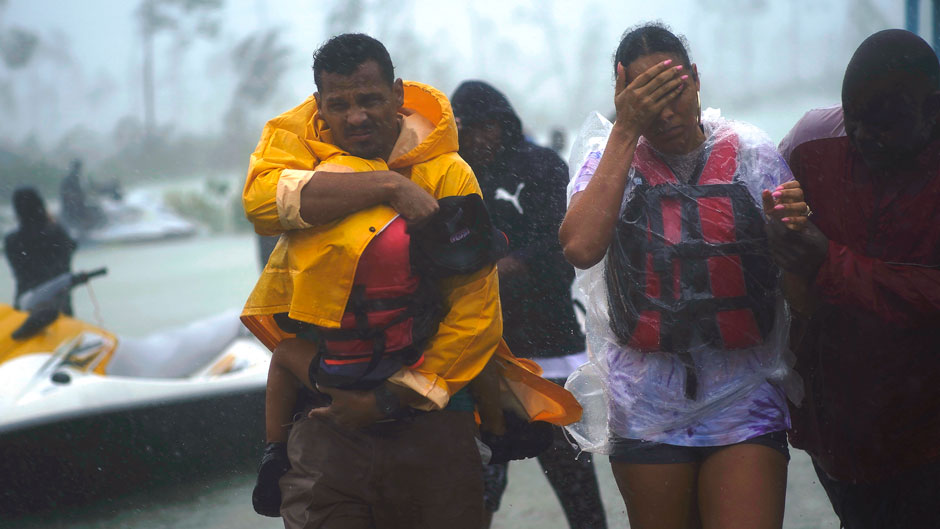
Powerful Hurricane Dorian slammed into the Bahamas on Sunday as a Category 5 storm, pummeling the tiny archipelago with its 185-mile-per-hour winds, devastating storm surge and torrential rains.
Making matters worse, the storm would eventually stall, giving itself more time to wreak havoc on the island nation.
The damage so far: five confirmed deaths and an estimated 13,000 homes destroyed.
Now, even as Dorian continues its slow crawl northwestward for the U.S. East Coast, forecasters continue to work around the clock to pinpoint the cyclone’s most likely path and predict its strength.
But one thing has already been established: Dorian, the fourth storm of the 2019 Atlantic hurricane season, is a record setter. The storm, for example, intensified at a rate never before observed, going from 150 mph to 185 mph winds in the span of just nine hours on Sunday.
A “perfect environment” of warm water, low vertical wind shear and remoteness from dry air and land all combined to fuel Dorian’s rapid intensification, according to Brian McNoldy, senior research associate at the University of Miami’s Rosenstiel School of Marine and Atmospheric Science.
“Few hurricanes take full advantage of such conditions when they’re available,” said McNoldy, who publishes his own blog, Tropical Atlantic Update, and has been the tropical weather expert for The Washington Post’s Capital Weather Gang since 2012. “As such, few hurricanes in the Atlantic record have ever reached an intensity like that. Only Allen (1980) is analyzed as stronger, and only by 5 mph.”
Hurricanes, he said, “are bad enough when they come and move through, but to have them stay for an extended visit is just devastating.”
Indeed, those conditions—warm water and low vertical wind shear—“were a recipe for disaster,” said Lynn “Nick” Shay, a professor of ocean sciences at the Rosenstiel School, who, along with graduate student Joshua Wadler, has been using Dorian as a laboratory to conduct experiments that could lead to better storm-intensity forecasts.
Working with Navy, U.S. Air Force and the National Oceanic and Atmospheric Administration (NOAA) scientists, the two researchers arranged to have high-tech GPS sondes and other data-gathering ocean devices deployed from Hurricane Hunter aircraft that flew directly into Dorian.
The instruments are sending back ocean temperature readings from as deep as 400 meters, augmenting our understanding of how much heat hurricanes can gain from the upper ocean.
Such information is critical to future ocean-atmosphere models, according to Shay. “It’s not just the track models that are important and are the wave of the future,” said Shay. “We need to get ocean information into the models to better predict intensity change.”
Shay described Dorian as a “super Category 5” storm. In fact, 2019 marks the fourth straight year with a Category 5 hurricane in the Atlantic. Could climate change be contributing to more intense storms?
“Our best climate change models predict that we will see more major hurricanes in the coming years,” said Ben Kirtman, a professor of atmospheric sciences and director of NOAA’s Cooperative Institute for Marine and Atmospheric Studies based at the Rosenstiel School. “In the past four years we have seen at least one Category 5 storm. This is the first time this has happened during the modern satellite era. So yes, there are some indications that we are starting to see some of the climate change signal.”
UM researchers weigh in on some of the other aspects of Dorian:
Why did Dorian stall over the Bahamas for so long and why is it such a slow-moving storm?
For days leading up to the encounter with the Bahamas, a slow-down was forecast prior to turning north somewhere in the vicinity of the Florida peninsula. But models failed to predict just how much the steering currents would deteriorate. A subtropical ridge to its north was not quite strong enough to keep nudging Dorian westward, and a mid-latitude trough well to its north was not quite strong enough to erode that ridge and allow Dorian to start moving north. Hurricanes just go along for the ride, and when there’s nothing to push them, they simply stop moving. Unfortunately, that occurred directly over the Bahamas.
—Brian McNoldy, senior research associate at the Rosenstiel School of Marine and Atmospheric Science
How is Dorian similar to other storms of recent history?
In recent years, we’ve seen some hurricanes slow down or stop near/over land, always with disastrous results. Joaquin in 2015 tracked into the Bahamas, stopped and turned back around as a Category 4 hurricane. Harvey in 2017 made landfall in Texas as a Category 4 hurricane, weakened and then stalled over eastern Texas as a tropical storm for several days, dropping record-breaking rainfall amounts. Florence in 2018 made landfall in North Carolina as a Category 1 hurricane, weakened and stalled over eastern North Carolina and South Carolina, dropping record-breaking rainfall amounts there. Hurricanes are bad enough when they come and move through, but to have them stay for an extended visit is just devastating.”
—Brian McNoldy, senior research associate at the Rosenstiel School of Marine and Atmospheric Science
Dorian weakened to a Category 2 storm on Tuesday. What caused the drop in intensity?
Dorian has been weakening since it reached its peak intensity on Sunday afternoon. It’s really hard to maintain that level of organization. On Tuesday, its peak sustained winds dropped to 110 mph, making it a Category 2 hurricane, which is still a really powerful storm. It is near land (Florida), it has probably upwelled slightly cooler water because of remaining so stationary, and the wind shear is gradually increasing. But the threat to central and northern Florida as well as Georgia, South Carolina, and North Carolina remains. Even with a weaker hurricane, and even if the eyewall remains offshore, significant storm surge will occur.
—Brian McNoldy, senior research associate at the Rosenstiel School of Marine and Atmospheric Science
What other factors can cause rapid intensification in storms?
That’s the big question right now. It’s still not exactly clear. What we do know is that if there’s plenty of deep warm water, limited vertical shear, no topography in the way, and no dry air, then the potential for rapid intensification is there. But getting the rates of heat transfer to the storm is the missing link. We aren’t really able to correctly account for the amount of heat coming off of the ocean and the amount of friction exerted by the ocean on the atmosphere, and that’s what we’re working on—trying to understand what the heat-transfer rates are.
—Brian Haus, professor and chair of the Department of Ocean Sciences at the Rosenstiel School and director of the Alfred C. Glassell, Jr. SUSTAIN wind-wave tank, which can simulate storm conditions up to a Category 5 hurricane.
Storm activity is picking up in the Atlantic and Gulf of Mexico after a slow start to the season. Why the uptick in activity all of a sudden?
As far as the uptick in activity, this is all pretty normal. The season is typically fairly quiet through mid-August, and then rapidly ramps up. Historically, the active part of hurricane season lasts into mid-to-late October, then officially ends at the end of November. We are now at the time of year when the large scale environment (atmosphere and ocean) supports hurricane formation across much of the Atlantic basin, so stay alert.
—Brian McNoldy, senior research associate at the Rosenstiel School of Marine and Atmospheric Science
Three possible major factors to consider: usual seasonal evolution in hurricane frequency—Sept. 9-10 is the peak of the hurricane season; the so-called Madden-Julian Oscillation, which can lead to active and inactive periods during the hurricane season. At this particular time, the MJO doesn’t seem to be a big factor; the warm ENSO state of a couple weeks ago transitioning into a relatively cool state, which can enhance hurricane activity. This probably is a factor. Of course, just random chance can also play a role.
— Ben Kirtman, a professor of atmospheric sciences and director of NOAA’s Cooperative Institute for Marine and Atmospheric Studies based at the Rosenstiel School